Anchorage to Seward: Seward Highway Scenic Byway Guide
Drive one of America's most breathtaking National Scenic Byways. Hug Turnagain Arm cliffs where Beluga whales surface, cross alpine Turnagain Pass, and descend into the marine fjord gateway of Seward.
The drive from Anchorage to Seward spans 127 miles along the Seward Highway (AK-1/AK-9), taking 2.5 to 3 hours without stops. It skirts the tidal Turnagain Arm before crossing the dramatic Kenai Mountains via Turnagain Pass (988 ft), terminating at Resurrection Bay in Seward.
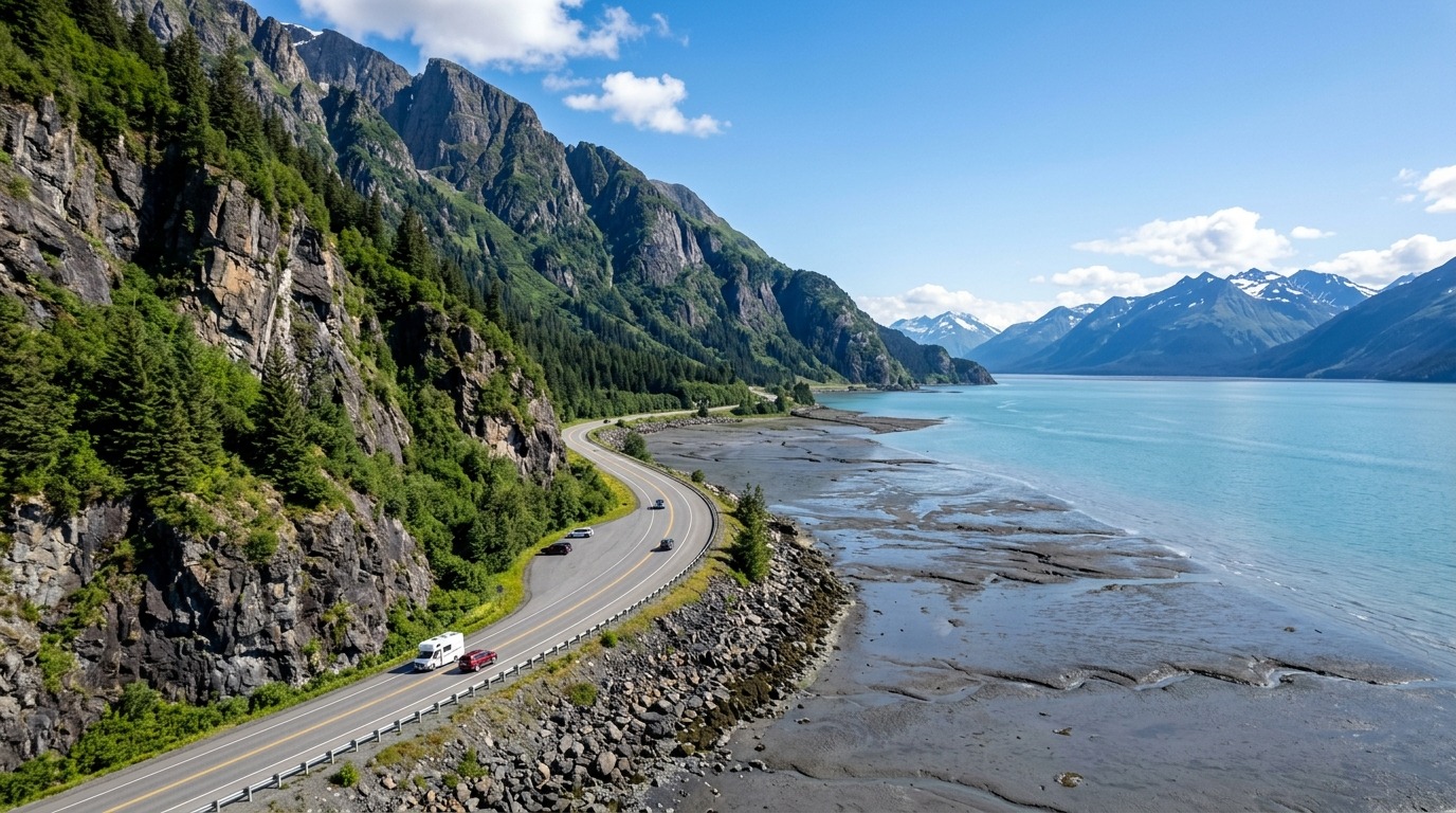
Route Overview & Landscape Narrative
The Seward Highway connects Alaska's largest city to the maritime port of Seward on Resurrection Bay. Designated an All-American Road by the Federal Highway Administration, this 127-mile corridor showcases glacial valleys, crashing bore tides, cascading alpine waterfalls, and world-class hiking trailheads.
Turnagain Arm Bore Tide & Beluga Point Whale Spotting
The first 50 miles of the Seward Highway south of Anchorage are carved directly into the sheer vertical metamorphic rock walls of the Chugach Mountains, tracing the shoreline of Turnagain Arm. This fjord experiences the second-highest tidal range in North America (up to 30 feet).
Twice daily, extreme incoming ocean tides collide with the shallow mudflats to create the Turnagain Arm Bore Tide?a continuous 4-to-10 foot standing wave that rushes down the inlet at speeds exceeding 15 MPH. Pull over at Beluga Point (Milepost 110.5) or Bird Point (Milepost 96) 2 to 3 hours after Anchorage low tide to watch this natural marvel. During July and August, pods of pure white Beluga whales ride the incoming tide into the arm to hunt silver salmon in the churning surf.
Turnagain Pass Alpine Crossing & Kenai Mountain Topography
At Milepost 79, the highway passes the 200-acre Alaska Wildlife Conservation Center before turning south into the glacier-carved Portage Valley. From here, the road begins a steady 10-mile ascent into the dramatic alpine tundra of Turnagain Pass (elevation 988 ft), the highest point on the Seward Highway.
Turnagain Pass marks the geographic boundary between the Chugach National Forest and the Kenai Peninsula. In summer, the treeless alpine valley floor explodes with vibrant purple lupine, pink fireweed, and yellow arnica wildflowers. In winter, this pass receives over 500 inches of snow, serving as Southcentral Alaska's premier backcountry skiing and snowmobiling sanctuary.
Mile-by-Mile Turnout Index: Anchorage to Seward
? MP 117.0 - Potter Marsh Boardwalk: Elevated wooden walkway over freshwater coastal marsh. Prime birding for trumpeter swans, northern pintails, and spawning king salmon in summer. ? MP 110.5 - Beluga Point Overlook: Rocky coastal promontory with mounted binoculars for whale watching and spotting Dall sheep on rocky roadside cliffs. ? MP 90.0 - Girdwood Junction: Gateway to Alyeska Resort, luxury Nordic Spa, and the last full-service fuel and grocery hub before Seward. ? MP 79.0 - Alaska Wildlife Conservation Center: Non-profit wildlife sanctuary caring for orphaned wood bison, brown bears, black bears, moose, and muskoxen. ? MP 68.5 - Turnagain Pass Rest Area: Alpine summit (988 ft) with heated ADA restrooms, interpretive exhibits, and paved mountain photography trails. ? MP 37.0 - Tern Lake Viewing Platform: Scenic wetland confluence of AK-1 and AK-9. Stop here to see nesting arctic terns and emerald alpine water. ? MP 29.5 - Moose Pass Historic Townsite: Charming lakeside community famous for waterplane docks, local fudge shops, and rustic log cabins. ? MP 0.0 - Seward Small Boat Harbor: Ocean terminus on Resurrection Bay and departure docks for Kenai Fjords National Park glacier catamaran cruises.
Wildlife Viewing Protocols: Dall Sheep & Coastal Brown Bears
The Seward Highway is one of the premier roadside wildlife safari routes in the United States. Scan the steep rock cliffs between Milepost 112 and Milepost 108 for bright white Dall sheep foraging on sparse lichen. If sheep are spotted, pull completely off the paved roadway onto designated turnout shoulders?never stop in active traffic lanes.
Along stream confluences like Bird Creek (MP 100) and Resurrection Creek, coastal brown bears and black bears frequently fish for returning pink and silver salmon from late June through August. Maintain a strict 100-yard distance from bears and carry accessible EPA-registered bear spray at all times.
Winter Hazards, Avalanche Chutes & Road Safety
Between October and May, Turnagain Arm is subject to severe subarctic coastal storms, black ice, and catastrophic avalanche activity. The Alaska Department of Transportation (DOT) operates active avalanche artillery mitigation programs along Mileposts 90 to 105, where steep mountain chutes drop directly toward the roadway.
Drivers traveling between November and April must equip vehicles with studded winter tires or severe snow-rated tires (Three-Peak Mountain Snowflake symbol). Always check the Alaska 511 system (511.alaska.gov) for road status before departing Anchorage.
Key Scenic Highlights & Points of Interest
- ?Beluga Point (MP 110.5): Elevated rocky ocean overlook for spotting summer Beluga pods and Dall sheep.
- ?Bird Point (MP 96): Paved paths and mounted telescopes offering panoramic vistas of Turnagain Arm mudflats.
- ?Girdwood / Alyeska (MP 90): Glacial valley resort town featuring the Alyeska Aerial Tram and luxury Nordic Spa.
- ?Alaska Wildlife Conservation Center (MP 79): 200-acre sanctuary caring for orphaned wood bison, brown bears, and moose.
- ?Turnagain Pass (MP 68.5): Highest point on the highway (988 ft) surrounded by alpine tundra and wildflower peaks.
- ?Tern Lake Junction (MP 37): Scenic mountain wetland fork connecting to the Sterling Highway toward Homer.
Essential Driving Tips & Subarctic Safety
Strict 55 MPH speed limit is strictly enforced along Turnagain Arm due to single-lane oncoming traffic.
Turn on low-beam headlights at all times as mandated by Alaska State Troopers for two-lane highway corridors.
Watch for sudden wildlife crossings, specifically moose between MP 100 and MP 60 at dawn and dusk.
Allow extra time on sunny summer weekends when local camper and RV traffic slows progress through mountain passes.
Mile-by-Mile Logistical Timeline: Seward Highway (All-American Road)
Official Ground-TruthPotter Marsh Wildlife Boardwalk
Elevated wooden boardwalk for spotting spawning salmon, trumpeter swans, and bald eagles.
Beluga Point Overlook
Rocky precipice overlooking Turnagain Arm with mounted viewing scopes for whale watching.
Girdwood Junction & Fuel Hub
Gateway to Alyeska Resort. Last major gas station, grocery store, and dining hub before Seward.
Alaska Wildlife Conservation Center
Non-profit animal sanctuary caring for orphaned and injured Alaskan big game.
Turnagain Pass Summit
Alpine summit (988 ft) separating Turnagain Arm from the Kenai Peninsula interior.
Tern Lake Viewing Platform
Crystal-clear glacier runoff lake and junction for AK-1 South to Cooper Landing and Homer.
Seward Small Boat Harbor
Historic terminus of the Seward Highway and departure point for Kenai Fjords National Park boat tours.
Calculate Gas Cost for Anchorage to Seward: Seward Highway Scenic Byway Guide
Estimate fuel volume and expenditure for your specific vehicle configuration along this corridor:
1. Configure Your Route
2. Vehicle & Fuel Details
Estimated Total Fuel Expenditure
Longest fuel gap on this route is 90 miles between Girdwood and Seward. Always top off before leaving town.
Frequently Asked Questions: Anchorage to Seward: Seward Highway Scenic Byway Guide
What is the speed limit and road condition on the Seward Highway (All-American Road)?
The standard posted speed limit is 55 MPH for two-lane stretches and up to 65 MPH on select divided sections. Road conditions are fully paved and maintained year-round, though seasonal summer construction and winter black ice require attentive driving.
Where is the longest fuel gap on the Anchorage to Seward: Seward Highway Scenic Byway Guide?
The longest stretch without gas services is 90 miles. No fuel services between Girdwood (MP 90) and Seward (MP 0). Always top off in Girdwood or Anchorage.